Main Concepts
Data
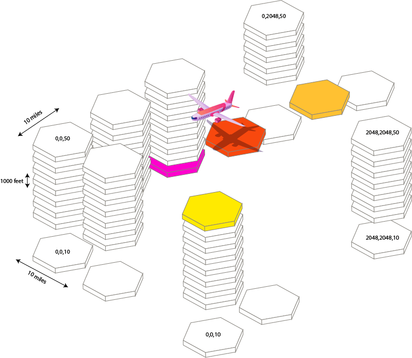
After extensive field trials, development & research, SkyPath decided to divide the world into 10x10 miles x 1000 feet high logical rectangular boxes, which were found to be the best balance; not to overload the pilots with information, but give enough granularity for the pilots to be able to take action and avoid CAT consequences.
SkyPath uses H3 hexagonal hierarchical geospatial indexing system with H3 resolution 5 to represent turbulence area by hexagons of different severity levels. SDK handles all work with H3 indexes out of the box so you don't need to do anything for it on your side.
SkyPath world map tiles logical view


